Philip's Junior School Atlas x 30 Pack
30copies

This product is not currently available.
To help you find what you're looking for, see similar items below.
This product has not been rated yet.
0 reviews (Add a review)

Delivery information
- FREE postage to schools*
- Postage charges apply to home addresses
- Delivery within 10 working days
Book Club orders
- FREE postage to schools*
- Books will be despatched after the school's order is confirmed
Delivery information and refund and returns policy
*We do not charge postage costs on your order, but border charges are payable and additional customs charges may be levied.
Product description
Maybe you’ve looked at a globe and been amazed by the sight of all the world’s countries. But did you know that maps can show you much more than just where places are? Landscape, population, industries, transport, tourism: maps can illustrate all these things. Clever, huh? Now this handy book shows you a huge range of maps, giving you all the skills you need to read them. Take a close-up look at the UK and Ireland. What cool stuff is right on your doorstep? Then check out all your must-see global destinations. The maps in here will be your guide…
- The market-leading atlas for National Curriculum KS2
- Clearly explains different map types, scale and symbols
- Covers topics including climate, industry, transport and energy
- 22-page section for the UK and Ireland, including regional maps
- Political and physical maps, plus an overview of each continent
- Published in association with the Royal Geographical Society
Supplied as a pack of 30 copies.
Product Details
Format
Paperback
Date published
June 6th, 2019
Condition
New
UK editionIn this pack
Reviews
This product has not been reviewed yet.
Add a review
Similar items
-

6copies
Connectors Ages 10+: Far-Flung Places x 6- eur prices
- Price: €50.70
- gbp prices
- Price: £39.00
-
6books
Connectors Ages 11+: Human Barriers - The Walls of the World x 6- eur prices
- Price: €50.70
- gbp prices
- Price: £39.00
-
Lift-the-flap Questions and Answers about Our World
- eur prices
- Price: €11.05
- gbp prices
- Price: £8.50
-
6books
Connectors Purple: A Dream Comes True x 6- eur prices
- Price: €50.70
- gbp prices
- Price: £39.00
-
6books
Connectors Gold: Too Wet, Too Dry x 6- eur prices
- Price: €50.70
- gbp prices
- Price: £39.00
-
6books
Connectors Orange: Working Children x 6- eur prices
- Price: €50.70
- gbp prices
- Price: £39.00
-
6books
Connectors Turquoise: Monkey City x 6- eur prices
- Price: €50.70
- gbp prices
- Price: £39.00
-
6books
Connectors Ages 9+: Ice - A Cold Blanket x 6- eur prices
- Price: €50.70
- gbp prices
- Price: £39.00
-
Stranger Places
- eur prices
- Price: €9.10
- gbp prices
- Price: £7.00
-
6copies
PM Gold: Rivers, Streams and Lakes (PM Plus Non-fiction) Levels 22, 23 x 6- eur prices
- Price: €51.87
- gbp prices
- Price: £39.90
- Not available to buy with Rewards
-
30copies
Oxford Primary Thesaurus x 30- eur prices
- Offer price: €264.80
- RRP: €311.61
- gbp prices
- Offer price: £203.70
- RRP: £239.70
-
6books
PM Sapphire: Mixed Pack (PM Non-fiction) Levels 29, 30 (6 books)- eur prices
- Price: €61.23
- gbp prices
- Price: £47.10
- Not available to buy with Rewards


Customers also bought
-
6copies
Nevermoor: The Trials of Morrigan Crow x 6Award-winning author
- eur prices
- Offer price: €62.30
- RRP: €62.32
- gbp prices
- Price: £47.94
-
5books
What to Read After: Diary of a Wimpy Kid Pack- eur prices
- Price: €48.05
- gbp prices
- Price: £36.95
-
Pass Your 11+: 11+ Mathematics Tests Ages 10-11
- eur prices
- Price: €9.10
- gbp prices
- Price: £6.99
-
Lift-the-Flap First Questions and Answers about Racism
- eur prices
- Price: €11.05
- gbp prices
- Price: £8.50
-
First Learning: Early Writing
- eur prices
- Price: €6.50
- gbp prices
- Price: £4.99
-
Horrible Histories: Cut-throat Celts
Award-winning team
-
Rising After the Fall: Afghan Women Share Their Stories
- eur prices
- Price: €14.35
- gbp prices
- Price: £11.05
-
Pass Your 11+: 11+ English Practice and Test for the GL Assessment Ages 10-11
- eur prices
- Price: €9.10
- gbp prices
- Price: £6.99
-
Fast Finishers: White Rose Maths Problem-solving: Ages 6-7
- eur prices
- Price: €39.00
- gbp prices
- Price: £30.00
-
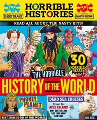
Horrible Histories: Horrible History of the World (newspaper edition)
Award-winning team
- eur prices
- Price: €11.05
- gbp prices
- Price: £8.50
-
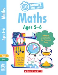
10-Minute SATs Tests: Maths - Ages 5-6
- eur prices
- Price: €7.80
- gbp prices
- Price: £5.99
-
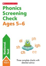
National Test Papers: Phonics Screening Check Ages 5-6
- eur prices
- Price: €10.40
- gbp prices
- Price: £7.99
-
Scholastic English Skills: Handwriting Practice Ages 9-11
- eur prices
- Price: €9.10
- gbp prices
- Price: £6.99
-
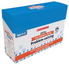
Fast Finishers: White Rose Maths Problem-solving: Ages 5-6
- eur prices
- Price: €39.00
- gbp prices
- Price: £30.00
-
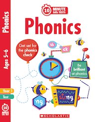
10-Minute SATs Tests: 10-Minute SATs Tests: Phonics - Year 1
- eur prices
- Price: €7.80
- gbp prices
- Price: £5.99
-
Scholastic Maths Skills: Times Tables Practice Ages 9-11
- eur prices
- Price: €9.10
- gbp prices
- Price: £6.99
-
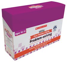
Fast Finishers: White Rose Maths Problem-solving: Ages 10-11
- eur prices
- Price: €39.00
- gbp prices
- Price: £30.00
-
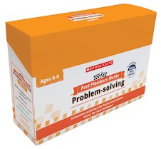
Fast Finishers: White Rose Maths Problem-solving: Ages 8-9
- eur prices
- Price: €39.00
- gbp prices
- Price: £30.00
-
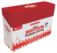
Fast Finishers: White Rose Maths Problem-solving: Ages 7-8
- eur prices
- Price: €39.00
- gbp prices
- Price: £30.00
-
Island
Award-winning author
- eur prices
- Price: €9.10
- gbp prices
- Price: £7.00
-
Read with Oxford: Stages 1-3: Biff, Chip and Kipper: Rhyming Games Flashcards
- eur prices
- Price: €8.40
- gbp prices
- Price: £6.45
-
Scholastic Maths Skills: Times Tables Practice Ages 7-9
- eur prices
- Price: €9.10
- gbp prices
- Price: £6.99
-
Phonics Workbooks: Book 3
- eur prices
- Price: €6.50
- gbp prices
- Price: £4.99
-
Phonics Workbooks: Book 2
- eur prices
- Price: €6.50
- gbp prices
- Price: £4.99
-
Barrington Stoke School Spelling Dictionary
- eur prices
- Offer price: €15.20
- RRP: €16.89
- gbp prices
- Offer price: £11.70
- RRP: £12.99
-
30copies
Oxford Primary Dictionary x30- eur prices
- Offer price: €264.80
- RRP: €311.61
- gbp prices
- Offer price: £203.70
- RRP: £239.70
-
Scholastic English Skills: Handwriting Practice Ages 7-9
- eur prices
- Price: €9.10
- gbp prices
- Price: £6.99
-
Future Hero #4: Battle for Sky Kingdom
- eur prices
- Price: €8.40
- gbp prices
- Price: £6.45
-
Black in Time
- eur prices
- Offer price: €9.35
- RRP: €10.39
- gbp prices
- Offer price: £7.20
- RRP: £7.99
-
Scholastic Maths Skills: Times Tables Practice Ages 5-7
- eur prices
- Price: €9.10
- gbp prices
- Price: £6.99


